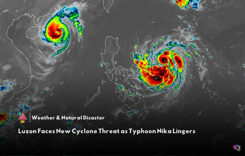
As Typhoon Nika (Toraji) continues to impact Luzon, another tropical cyclone has formed. The tropical depression developed outside the Philippine Area of Responsibility (PAR) early on Monday (11 November) and is expected to enter the area by Tuesday morning (12 November). Once inside PAR, it will be given the local name Ofel and could bring additional weather challenges to the region.
As of Monday morning, the tropical depression was located 1,480 kilometers east of Eastern Visayas and moving west-northwest at 35 kilometers per hour. Its maximum sustained winds have risen to 55 km/h, with gusts reaching 70 km/h. PAGASA expects the storm to intensify steadily over the next few days and potentially become a typhoon by Wednesday (13 November).
If it follows its projected path, Ofel may land in Northern or Central Luzon between Thursday evening (14 November) and early Friday (15 November). However, PAGASA has noted that the storm’s track could still shift within the forecast confidence cone. This storm could make landfall at or near its peak intensity, heightening risks for affected areas.
Northern Luzon, and possibly eastern parts of Central and Southern Luzon, could experience heavy rain, strong winds, and storm surges. Sea conditions may become hazardous along the eastern coasts of Bicol and Eastern Visayas by mid-Wednesday, while the northern and eastern seaboards of Luzon could face similar risks through the weekend. Meanwhile, another tropical storm, Man-yi, remains far from PAR but is being monitored for potential impacts.
References


Hiya! Quick question that’s totally off topic. Do you know how to make your site mobile friendly? My blog looks weird when viewing from my iphone. I’m trying to find a template or plugin that might be able to correct this problem. If you have any suggestions, please share. Cheers!
Your article helped me a lot, is there any more related content? Thanks!
I don’t think the title of your article matches the content lol. Just kidding, mainly because I had some doubts after reading the article.