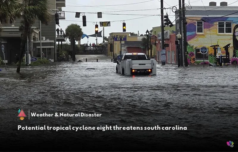
Potential Tropical Cyclone Eight is currently situated off the South Carolina coast and is expected to strengthen into a tropical or subtropical storm before making landfall along the northern South Carolina coast later on Monday (16 September). The National Weather Service (NWS) has been closely monitoring the system, which poses significant risks to the region.
In anticipation of the storm, the NWS has issued a flood watch for Bladen County that will remain in effect through Tuesday (17 September) morning (local time). The watch warns of the potential for flash flooding caused by excessive rainfall, with heavy rain expected on Monday (16 September) night (local time). Rainfall amounts could exceed 5 inches in some areas, raising concerns about flash flooding throughout the watch zone.
A tropical storm warning has also been declared for several counties, including Central Horry, Coastal Brunswick, Coastal Georgetown, Coastal Horry, Coastal New Hanover, Coastal Pender, and Inland Georgetown. According to the NWS, heavy rain could lead to flash flooding, particularly near the South Carolina coast and in parts of North Carolina. Additionally, tropical-storm-force winds are anticipated mainly along the coast, which could create hazardous marine conditions, surf, and minor coastal flooding.
As of 5 a.m. (local time) on 16 September, the storm was approximately 130 miles south-southwest of Wilmington, North Carolina, or about 100 miles south-southeast of Myrtle Beach, South Carolina. The storm is currently moving northwest at 3 mph, with wind speeds recorded at 50 mph. Authorities are urging residents in the affected areas to remain vigilant and prepare for possible severe weather conditions as the system approaches.
References

I don’t think the title of your article matches the content lol. Just kidding, mainly because I had some doubts after reading the article.