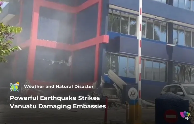
A powerful 7.3-magnitude earthquake struck Vanuatu on Tuesday (17 December). Its epicenter was located 30km west of the capital, Port Vila, at a depth of 57.1km. The earthquake caused significant damage, including to a building housing several foreign embassies, such as those of the US, UK, France, and New Zealand.
The US Embassy in Port Vila reported extensive damage and announced its closure until further notice. The US government expressed solidarity with those affected and promised to coordinate with Vanuatu’s authorities. Videos and photos showing the damage in Port Vila began circulating online.
Small tsunami waves, measuring up to 25cm, were observed in Port Vila, prompting initial tsunami alerts. However, these warnings were soon lifted. New Zealand’s National Emergency Management Agency and GNS Science confirmed no tsunami threat to New Zealand, advising citizens in Vanuatu to follow local authorities’ guidance.
The Australian Bureau of Meteorology also reported no tsunami threat to Australia. Vanuatu sits at the intersection of the Australian and Pacific tectonic plates, making it one of the world’s most seismically active areas. Historically, earthquakes of this magnitude are relatively rare, with the largest recorded being a 7.9-magnitude quake in 1950 near Port Vila.
References


